48 DALTON DIVISION RD
Owner Information
PECK KYLE W & REBECCA K
48 DALTON DIVISION RD
DALTON, MA 01226


Property Details
48 DALTON DIVISION RD is classified as a Single Family Residential (Ranch).
The primary structure on this property was built in 1952. There are 1,599ft2 of built area within this property. There is 1,599ft2 of residential/living space within this property. This property is listed as having 6 rooms.
48 DALTON DIVISION RD is valued at $156,700. The land is valued at $45,600 and the structures are valued at $110,200. There is an additional valuation of $900 on this property.
This property is in Zone R2. Confirm with local Zoning Board authorities to ensure there are no overlays or other easements on this property.
The most recent deed for 48 DALTON DIVISION RD is recorded at the local registrar in Book 3623, Page 0196. 48 DALTON DIVISION RD was last sold on Friday, September 15, 2006 for $152,500.
Assessment data from fiscal year 2021.
Flood Data
According to the FEMA National Flood Hazard Layer, this property does not appear to be in a flood zone. It may also be in an area not yet reviewed. Nonetheless, confirm this information prior to taking any action.
To view the flood hazards around this property, create a FEMA "Firmette" Map of the area around 48 DALTON DIVISION RD.
Broadband Internet Providers
| Provider | Type | Bandwidth (mbps) | |
|---|---|---|---|
| Viasat Inc | Satellite | 35 | 3 |
| Verizon New England Inc. | DSL | 3 | 0 |
| HughesNet | Satellite | 25 | 3 |
| GCI Communication Corp. | Satellite | 0 | 0 |
| Charter Communications Inc | Cable | 940 | 35 |
| VSAT Systems, LLC. | Satellite | 2 | 1 |
Broadband service provider data from December 2020.
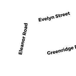
Adjacent Properties
- 49 ELEANOR RD
Single Family Residential owned by NYE SYLVIA J & - 42 DALTON DIVISION RD
Single Family Residential owned by MASTON DENNIS M SR & LISA A - 55 ELEANOR RD
Single Family Residential owned by BOINO ROSEMARY T L/E - 43 ELEANOR RD
Single Family Residential owned by LECOURS TYLER JAMES & - 54 DALTON DIVISION RD
Single Family Residential owned by CANN JONATHAN &